Readings may be taken at different water sources such as wells, boreholes, reservoirs, observation pipes, and reservoirs, as well as in controlled environment pump tests. Here we will discuss some of the key elements regarding water level inspections.
- What does a water level inspection usually include?
- Why are these inspections conducted by water supply and management companies?
- How does Fielda help inspectors conduct water level inspections with incredible speed, accuracy, and efficiency?
What do typical water level inspections include:
Hydrologic changes and stresses can impact water levels in the short and long term. Therefore, inspectors collect relevant data points to track these patterns and have information such as the exact location coordinates of the water level measurement, the date of measurement, and the depth of the water with the proper unit of measure used. They also add details regarding the measurement method used and if the current reading represents a dip or elevation in the water level.
Why these inspections are so crucial for planning and operations:
Besides merely collecting and tabulating data of water level readings, one of the main objectives of regular level inspections is to discern patterns and trends. Inspectors create level hydrographs that graphically show changes in water levels based on seasonal changes and hydrologic stresses in the short and long term. This data helps water experts determine the supply quantity and the geological shifts impacting water supply to make operational plans based on this intelligence accordingly.
How does Fielda help inspectors collect and manage water level data more efficiently:
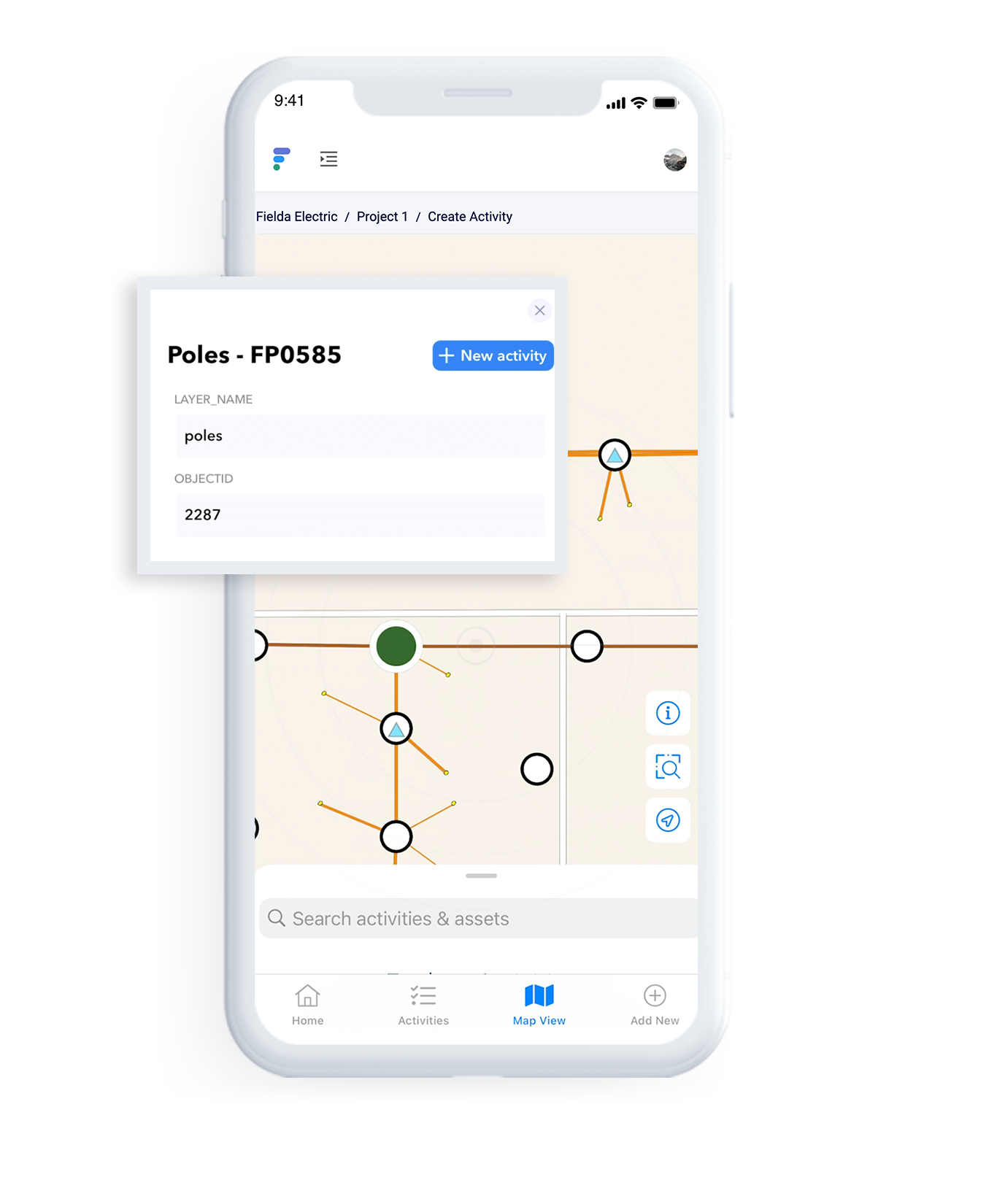
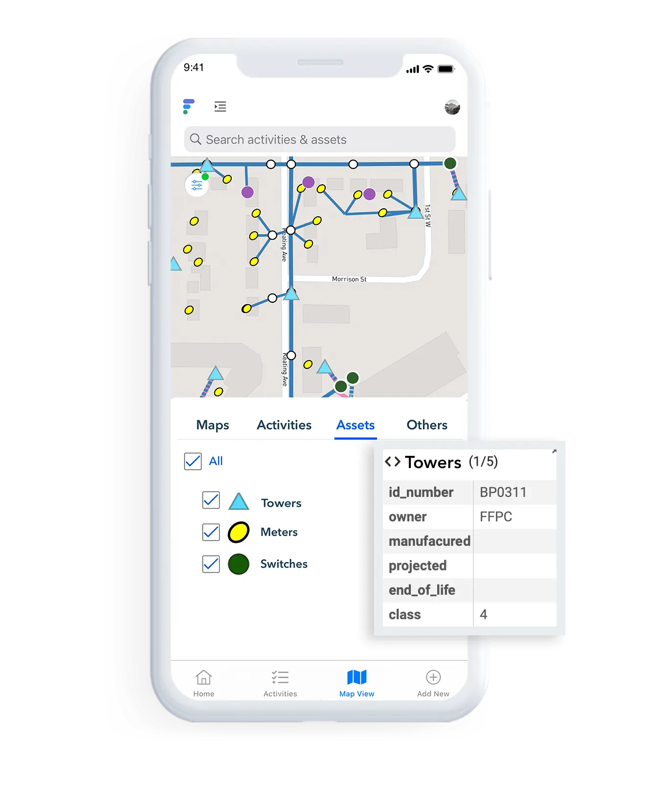
GIS plays a vital role in water level inspections. They help inspectors locate and map water sources where level readings are taken and refer back to them when needed over a period. Fielda has advanced GIS capabilities to enable inspectors to visualize and accurately track water source locations. In addition, with custom digital forms, inspectors can create and modify checklists as required and design custom workflows to collaborate effectively with other operational teams.
Collect: Leverage Fielda’s offline capability to collect water level readings even in off-grid locations
Share: Connect collaborating teams with transparent and real-time data sharing
Strategize: Gain insights from Fielda’s dashboards and metrics to make informed planning and operational decisions
About Fielda: Fielda helps companies manage and maintain their assets and gain real-time oversight of all tasks, workflows, and projects to improve operational efficiency, enhance team productivity and impact the bottom line. Whether it’s installations, inspections, repairs, replacement of parts, servicing and maintenance, or routine audits, with Fielda’s mobile data collection, GIS-enabled technology, automated and custom workflows, and analytics, you can eliminate errors, enhance response time, ease workflow bottlenecks, and simplify your field operations.